Red Snow, Blue Snow?
Well, think about the recent elections for a moment. Now we just had about 3 feet of snow in the past two storms and I've noticed a sort of Red/Blue divide in the reaction. We live in the country and have some 400 feet of driveway. All of our neighbors are in a similar situation - there are no "cul de sacs" around here. When the snow storms hit, there was a drive to demonstrate self-sufficiency. People cleared their own drives, dug out the best they could and helped their neighbors dig out too. People expect and prepare for every situation.
So when we watched some TV news coverage of the storm from Denver recently it seemed to be a quite different reaction. There was a lot of complaining, moaning and blame going around. "Why hasn't CDOT cleared my cul-de-sac?" "Where are those road crews anyway?" There seemed to be a sense of: Poor pitiful me, why hasn't the government stepped in to help me out?
So sometimes it takes a crisis like this to bring out the world-view of people. Some believe they should take care of themselves and be prepared, while others seem to think everything should be the responsibility of someone else.
Saturday, December 30, 2006
Friday, December 29, 2006
December Blizzard v2.0

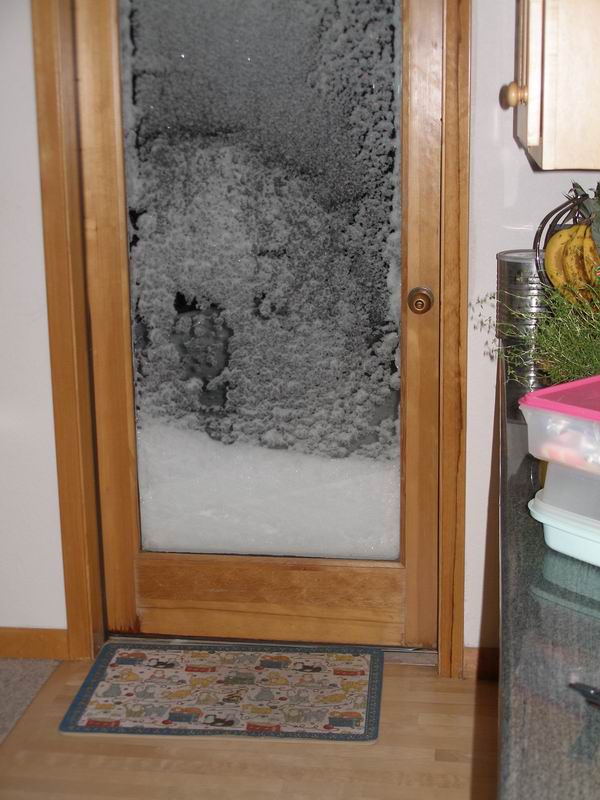
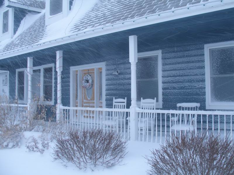
Posted 3PM December 29th: Just like the original but with new features. This is the second major blizzard in a week. This time we got a new feature with the blizzard - a power blackout. This new blizzard hit last evening and by 10 PM we had about 8 new inches on top of the old snow from before Christmas. About 9PM last night, the power went out suddenly and without a flicker. We could tell it was going to be out for a while. We scrambled to locate flashlights and candles and thought we were set for the evening.
But then I remembered that while we did fuel the car & truck before the snow started, I had neglected to get some extra fuel for the generator or for the John Deere. I got the tractor out and started plowing a path to the road and by 10 PM, was ready to go out looking for gas. Kenny and I took the SUV and drove about 6 miles south and passed by a half-dozen gas stations - all closed and all without power. We turned west toward Louisville and went a few more miles and saw no power anywhere except for a few emergency generators. By then the blizzard was ragging and the winds were blowing the snow at 30 MPH. We turned around and returned safely home empty handed. We got a few extra blankets out and decided to leave the generator off for the night (no heat).

Sometime during the night the snow stopped and the power was restored. In the morning I finished plowing the drive and went out again with Kenny for fuel (just in case). The weathermen were saying that the situation would get worse later this evening when the second wave would hit. At the first station, we found power, but the pumps were closed - no fuel! We continued on a few more miles down the road and found another station pumping the precious unleaded. We returned with a fresh five gallons of the stuff and felt ready for the next wave.
Get up to the minute weather data for our storms at this link: http://www.leyner.org/
Here is what the National Weather Service said today:
Urgent - Winter Weather Message National Weather Service Denver Co 1125 AM MST Fri Dec 29 2006 ...Heavy snow to continue today for most areas of northeast and north central Colorado... .bands of moderate to heavy snow will continue to affect the northeast plains of Colorado through this afternoon. West of interstate 25...only light snow is expected through the day. Stronger winds over the northeast plains will also cause near zero visibilities in blowing and drifting snow. North winds from 15 to 30 mph can be expected with some gusts up to 35 mph. The storm is currently centered over southwestern New Mexico and is expected to move slowly northeastward into the Texas panhandle by Sunday morning. This track will produce strong winds and heavy snowfall for the northeastern border counties of Colorado now through much of Sunday. This storm track could also produce heavy snowfall for the rest of the plains of northeast Colorado, the front range foothills and higher mountains east of the divide for much of the weekend. This includes the Denver metro area and all the urban corridor. There are still uncertainties regarding the duration of the heavy snow west of interstate 25 and whether heavy snow will redevelop near the mountains this weekend. Because of this a winter storm watch continues through Saturday night for the north central mountains and front range foothills and the plains through Sunday afternoon. All people planning to travel across northeastern and north central Colorado today through the weekend should be prepared for road closures and very difficult winter driving conditions. Roads will be icy and snow packed and blowing and drifting snow will become more of a problem on the plains with time. You are urged to avoid any unnecessary travel and carry items such as a shovel, food, water and warm clothing if you do go out. The storm has also disrupted air travel at Denver International Airport. Air travelers should check with their airlines for delayed or canceled flights.
Northwest Weld County- Boulder And Jefferson Counties below 6000 feet/West Broomfield County- including...Fort Collins... Hereford... Loveland... Nunn... Arvada... Boulder...Golden...Lakewood...Longmont 1125 AM MST Fri Dec 29 2006: Winter storm warning is cancelled… Snow and blowing snow advisory in effect until 6 am MST Saturday. Winter storm watch now in effect from Saturday morning through Sunday afternoon. The national weather service in Denver has issued a snow and blowing snow advisory, which is in effect until 6 am mst Saturday. The winter storm warning has been cancelled. The winter storm watch is in effect from Saturday morning through Sunday afternoon. The bands of heavier snow showers are expected to remain east and south of Denver. Therefore the winter storm warning has been downgraded to a snow and blowing snow advisory. Additional accumulations of 2 to 6 inches are still possible through tonight. The potential still exists additional heavy snowfall and strong winds Saturday through Sunday as the storm continues to move slowly northeastward. Additional snowfall accumulations of 6 to 12 inches will be possible over the weekend along with areas of blowing and drifting snow. A snow and blowing snow advisory means that visibilities will be limited due to a combination of falling and blowing snow. Use caution when traveling, especially in open areas. A winter storm watch means there is a potential for a hazardous winter weather event in and close to the watch area. Significant snow accumulations may occur that could impact travel. Stay tuned to the national weather service or your local news media for the latest updates and possible warning concerning this potential winter storm.
Blizzard Update: Dec 21, 2006
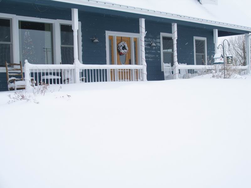

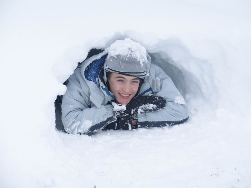
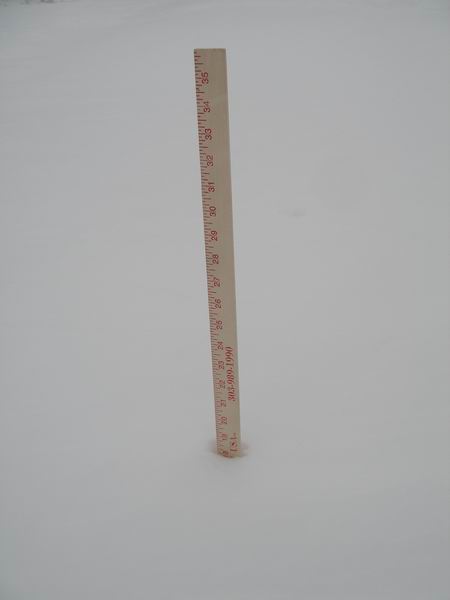
Update: 10AM, December 21st: We are officially "snowed-in". After about an hour attempting to clear the driveway, I gave up on the John Deere. The snow was so far over the top of the snow blade, it was not able to go straight down the driveway. See the pictures below. The boys are having a great time digging forts in the snow. We've got fresh bread in the oven and plenty of hot cocoa to keep us warm. My official report was 25.5" for the 24 hour period ending at 7AM this morning (see map), but as you can see from the new yardstick photo, it is showing 28" now. (Be patient while the pictures download. The snow drifts may be impacting our broadband connection.)

Blizzard Report: Dec 20, 2006
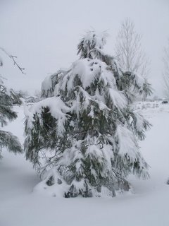
 Posted: 10PM December 20th: This has been the biggest blizzard we have had since we lived in Colorado for the past 7 years and it's not over yet. We measured from 14 to 20 inches of snow in most places of the yard. With the winds some of the drifts were over 4 feet deep by sunset.
Here is the weather service warning for that night:
URGENT - Winter Weather Message
National Weather Service Denver Co 359 pm MST Wed Dec 20 2006
...Strong winter storms to continue over northeast and north central Colorado tonight into Thursday morning .a major winter storm will continue bringing widespread moderate to heavy snow and blizzard conditions to northeast and north central Colorado this tonight into Thursday morning. The storm producing this weather is centered over the extreme southeast corner of Colorado. It is expected to move little through Thursday morning.
At 4 pm MST...snowfall amounts over the plains range from about 6 to 11 inches so far with the storm. The urban corridor has seen about 9 to 14 inches so far. The foothill and Palmer Ridge...including the southern and southwestern great Denver area have had 14 to 21 inches thus far. The higher mountains east of the divide have had 12 to 22 inches so far. Wind gusts of 30 to 40 mph are widespread across the plains with snow drifts up to 6 feet. Travel has become impossible this afternoon across most of northeast and north central Colorado. Travel is not recommended through Thursday morning.
Boulder and Jefferson counties below 6000 feet: 359 pm MST wed Dec 20 2006: A blizzard warning remains in effect until 12 pm MST Thursday. Snow heavy at times will continue into Thursday morning. Total accumulations of 12 to 24 inches are expected in most locations by Thursday morning. As much as 30 inches of snow will fall in the southern and southwestern metro Denver suburbs and the Palmer Divide area. North winds of 20 to 35 mph will produce blizzard conditions. Travel is not recommended through Thursday morning.
Subscribe to:
Posts (Atom)


